You know Mercado Libre (the Amazon of Latin America), and you trust Visa, PayPal, FedEx, DHL.
We connect the dots — simply.
No customs mess. No extra fees. Just what you want, delivered fast with prepaid pricing.
Explore more products by
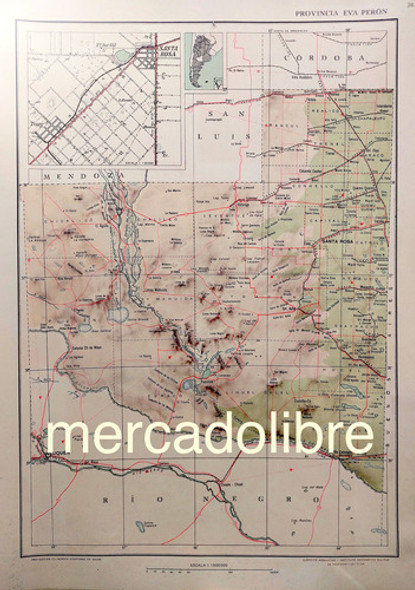
Mapa 1953 Provincia San Juan Con Region Eva Peron
Mapa 1953 Provincia San Juan Con Region Eva Peron
30-Day Money-Back Guarantee
Not satisfied? Return within 30 days for a full refund.
All tariffs & duties are already pre-paid and pre-cleared. No additional payments will be required on delivery.
- Shipping Time:
- Ships within 2-5 business days after your purchase. We will receive your product at our warehouse and carefully package it for international shipping.
- SKU:
- MLA1414358245
- Condition:
- Used
- Weight:
- 0.65 KGS
Description
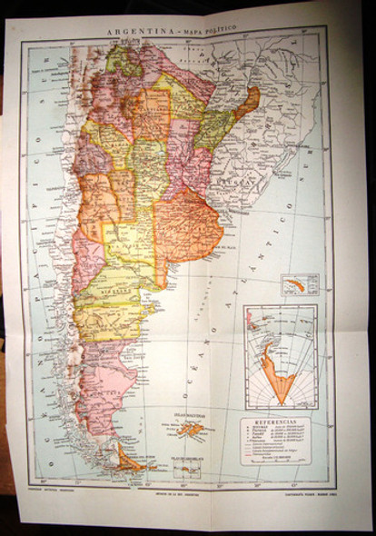
Shop Mapa 1953 Provincia San Juan Con Region Eva Peron and more Pósters at Latinafy.comUnlock a piece of history with this stunning 1953 political physical map of San Juan Province, featuring the renowned Eva Perón region. Crafted during the presidency of Juan Perón and printed by the Argentine Army (I.G.M.), this vintage map showcases essential routes, including the national route in bold red and air navigation paths, making it a unique collector's item. Measuring 48 x 34 cm, it's perfect for framing or displaying in any space. As an added bonus, enjoy a separate sheet featuring photographs and relevant data of San Juan Province from the same year. This map is in excellent condition, bringing a vivid piece of Argentina's history to your collection.Discover a remarkable piece of Argentine history with this physical political map of San Juan Province from 1953, which encompasses the celebrated Eva Perón region. This map, produced during the iconic Juan Perón's administration, boasts vibrant colors and is printed by the Argentine Army (I.G.M.). It features a variety of essential mapping details such as railroads highlighted with dotted black lines, national routes delineated in striking red, and aerial navigation paths marked with a dotted red line and an airplane icon. Additionally, the map captures cities and towns, as well as notable geographical features, offering a comprehensive view of the region during that time.
Measuring 48 x 34 cm, this historic map presents the city of San Juan in a separate framed section, drawing appreciation not just for its utility in navigation but also as a collector’s item. Alongside the map, you'll receive an additional sheet filled with photographs and information about the province in 1953, enriching your experience and understanding of this period. In pristine condition, this vibrant map represents an exceptional opportunity to own a fragment of the past that will spark conversation and admiration in any home or office setting.Usage ideas
This vintage map is ideal for display in a home office, study, or as part of a decorative collage. It serves as a fantastic educational tool for history enthusiasts, students, or anyone interested in Argentine heritage. Gift it to a teacher, historian, or map collector to celebrate their passion for geography. Use it as a unique wall art piece in cafes or libraries to inspire curiosity about Argentine history and landscapes. The map is also suitable for framing, adding a touch of vintage elegance to your decor.Frequently asked questionsIs this map suitable for framing?: Yes, with its dimensions of 48 x 34 cm, it is perfect for framing and will enhance any wall.What year was this map printed?: This map was printed in 1953.Can I learn more about the regions shown in the map?: Absolutely! The map includes various cities, towns, and geographical features of San Juan Province.Is the additional sheet included?: Yes, the additional sheet with photographs and data from 1953 is included as a bonus.What condition is the map in?: The map is in excellent condition, showcasing its vibrant original colors.- Marca: Mapa 1953 Provincia de San Juan Con Region Eva Peron- Condición del ítem: Used- Modelo: See More Data in Description- Ancho: 34 cm- Altura: 48 cm- Acabado: Matte- Material: Paper- Es producto personalizado: No- Incluye marco: No- Tipo de impresión: Color- Tema: MapsVendor listing title: Mapa 1953 Provincia San Juan Con Region Eva Peron
View AllClose
Additional Information
Origin: |
Argentina |
Vendor: |
Shop on Mercado Libre Argentina |
Brand: |
Mapa 1953 Provincia San Juan Con Region Eva Peron |


